
Warsaw – Across the Warsaw Ghetto
Distance to walk: 7 kilometres
Estimated walking time: 3.5 hours
Starting point: Remains of the Ghetto Wall in 55 Sienna Street and 62 Złota Street
Route stops:
- REMAINS OF THE GHETTO WALL, 55 Sienna Street and 62 Złota Street
- BERSOHN AND BAUMAN CHILDREN’S HOSPITAL, 60 Sienna Street and 51 Śliska Street
- CHMIELARNIA, 42 Twarda Street
- TENEMENT HOUSES & GHETTO WALL, Waliców and Pereca streets
- THE BRIDGE BETWEEN THE “SMALL” AND THE “BIG” GHETTO, crossroads of chłodna street and żelazna street
- CAFE BAR PARAGRAF, 84 Solidarności Avenue
- LESZNO COURTHOUSES, 127 Solidarności Avenue
- CZEŚĆ, 2 Grzybowska Street
- PRÓŻNA STREET
- NALEWKI STREET & ENTRANCE TO THE KRASIŃSKI GARDENS, Stare Nalewki Street
- GHETTO HEROES MONUMENT & POLIN MUSEUM OF THE HISTORY OF POLISH JEWS, Bohaterów Getta Warszawskiego Square
- UMSCHLAGPLATZ, 5/7 and 10 Stawki Street0
- ANIELEWICZ’S MOUND & BUNKER, Miła and Dubois streets
- CRAFT BEER MURANÓW, 23 Andersa Street
This is a trail like no other. Its aim is to familiarise the residents of Warsaw and tourists alike with the extraordinary and dramatic 20th century history of the Jewish people during the Nazi German occupation of 1939-1945. It is inextricably intertwined with the history of the city itself, which in its hitherto shape as a matter of fact ceased to exist after the fall of the Warsaw Uprising in autumn 1944.
Nowadays, one can find very few material “witnesses” of the daily hardships in the Warsaw Ghetto. As resident of the city, it is impossible to pass them by indifferently or pretend that nothing noteworthy had ever happened here. Anybody aware of the tragedy that took the lives of many, going about their daily grind, should know the history of individual places and approach them with the highest respect.
From all the stops on this trail, pubs are definitely a minority. Their purpose is to be a pitstop while exploring places explaining the tragic history of the Warsaw Ghetto. Let us remember that a short rest with a glass of beer in hand may be the perfect time for reflection and reconsideration of certain matters that may end up re-evaluated when faced with such a dramatic story.
The author of this trail is Michał ‘Docent’ Maranda whose two passions are craft beer and history. He has been pursuing his beer interests for over a decade as editor of PolskieMinibrowary.pl (Polish Microbreweries) dedicated to Polish beer and small breweries. He is also an expert on the genocide of the Jewish people during Nazi German occupation, in particular the subject of extermination camps – this was the focus of his Master’s thesis “Nazi death camps. Description and an attempt to analyse the phenomenon” („Nazistowskie obozy zagłady. Opis i próba analizy zjawiska”).
Descriptions of historical places are based on entries from the Polish Wikipedia and the website Warszawa1939.pl. All photos (except stated otherwise) were taken by Michał ‘Docent’ Maranda.
Translation by Mirek Kołodziej, Warsaw-born and raised fan of craft beer who always remembers to tell his foreign friends visiting his city that back in the day there were many Jews living in this city and their history must not be forgotten.
Edited by: Paweł Leszczyński.
If you find any mistakes at all or would like to share some constructive criticism concerning our project, be sure to let us know!
Introduction:
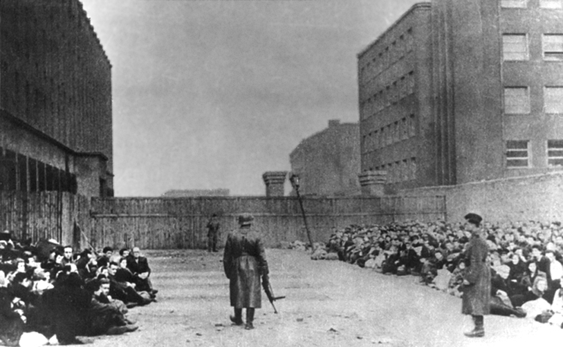
The history of Warsaw is inextricably linked with the history of the Jewish people In 1939, close to 360,000 of them lived in the capital of the Republic of Poland and they made up 1/3 of the city’s total population. Second only to New York City, this was one the largest Jewish diasporas in the world. Nazi occupation of Poland brough about the tragic end of this community. Established in October 1940, the newly formed Warsaw Ghetto in the central-northern part of Warsaw covered an area 3.4 km2. It was separated from the rest of the city with a three-metre-tall wall. About 450,000 Jews were forced to live in this relatively small area at the peak of April 1941. The inhumane conditions in the ghetto, such as overcrowding and above all hunger (the food ration per person amounted 400 calories a day) resulted in the death of 92,000 people. In July 1942, in accordance with the so-called “Final Solution to the Jewish Question” (Endlösung der Judenfrage), the “Great Action” (Grossaktion Warschau) began. Within two months, approximately 300,000 people were deported by train from the so-called Reloading Square (Umschlagplatz), that is close to 75% of the total population of the ghetto, to the death camp in Treblinka (SS-Sonderkommando Treblinka), 105 km north-east of Warsaw, where these people were murdered in gas chambers immediately after their arrival.
When the liquidation action had been completed, only the northern part of the ghetto remained where still about 60,000 Jews, mostly young people, lived and worked in production plants, or the so-called “shops”. In January 1943, during the next series of deportations to Treblinka, the first of several armed resistance actions took place. The 19th April 1943 was appointed by the German occupant as the date of the final liquidation of the ghetto. The Jews organised themselves into two main combat organisations (ŻOB – Żydowska Organizacja Bojowa, the Jewish Combat Organization or Yidishe Kamf Organizatsie, and ŻZW – Żydowski Związek Wojskowy, Jewish Military Union or Jidisze Militerisze Farajnikung) and resisted. Their fight lasted until mid-May. On 16th May 1943, the Great Synagogue in Tłomackie Street was blown up, which was supposed to be a symbol of the end of the Jewish quarter in Warsaw. The burnt out, deserted area of the former ghetto was later systematically demolished. In the summer of 1943, a concentration camp for the Jews (Waffen-SS Konzentrationslager Warschau) was established in this area, whose task was to carry out demolition works in the former ghetto. The camp was captured on 5th August 1944 during the Warsaw Uprising. On that day, 348 Jews were freed from the lager, most of them brought from abroad. As a result of the liquidation of the Warsaw Ghetto, approximately 12% of the city’s buildings at that time were completely destroyed, mainly in its central-northern part.
BACK TO THE MAP / BACK TO THE LIST
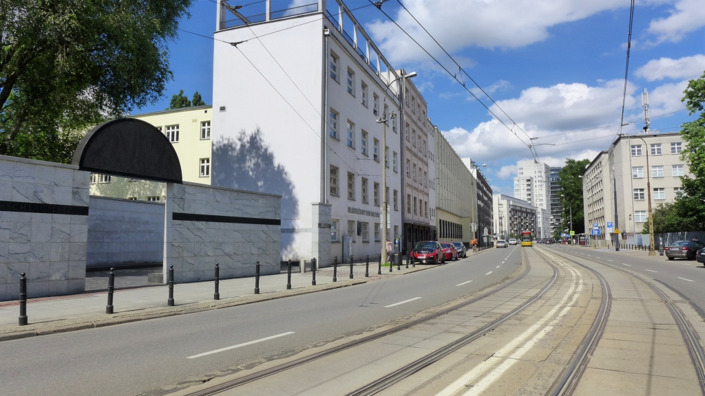
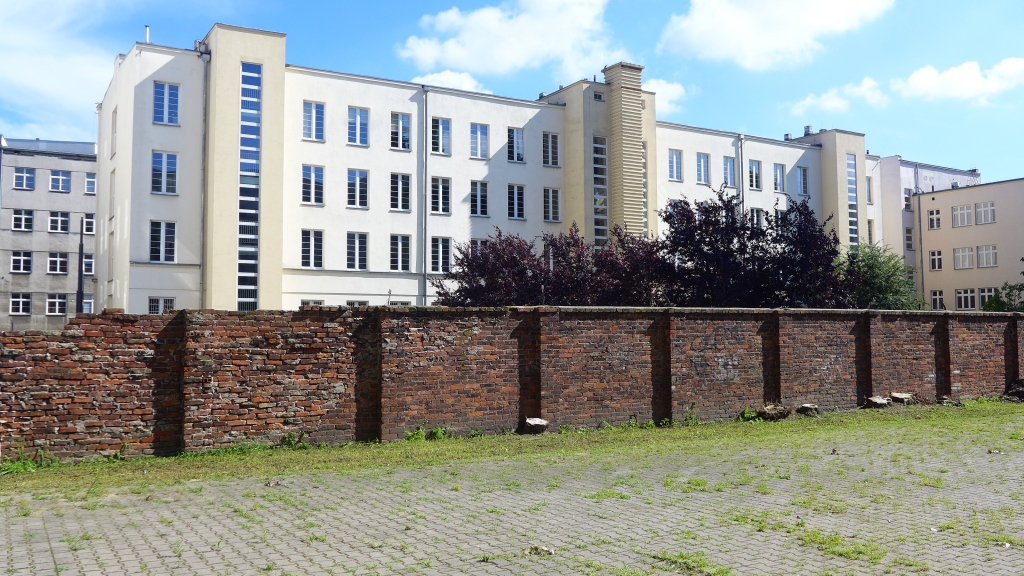
1. REMAINS of the GHETTO WALL
55 Sienna Street and 62 Złota Street
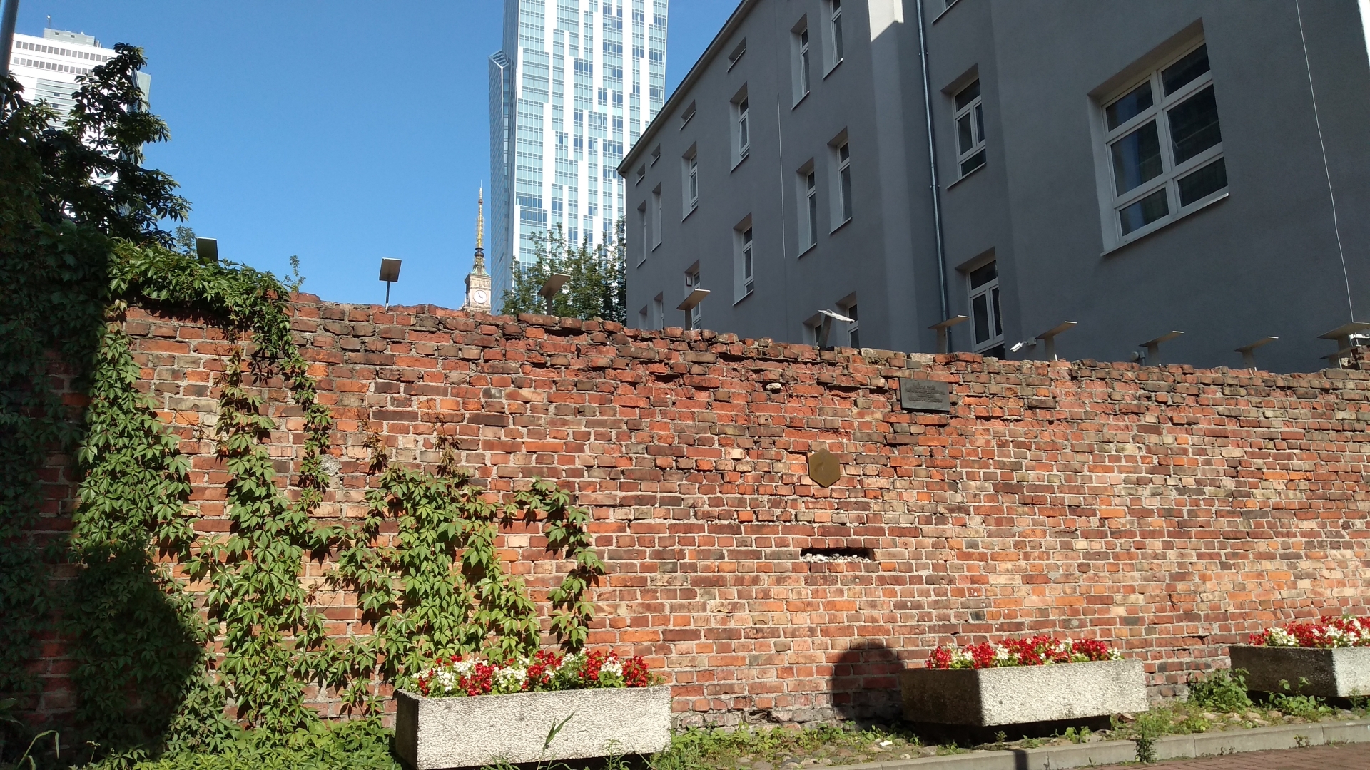
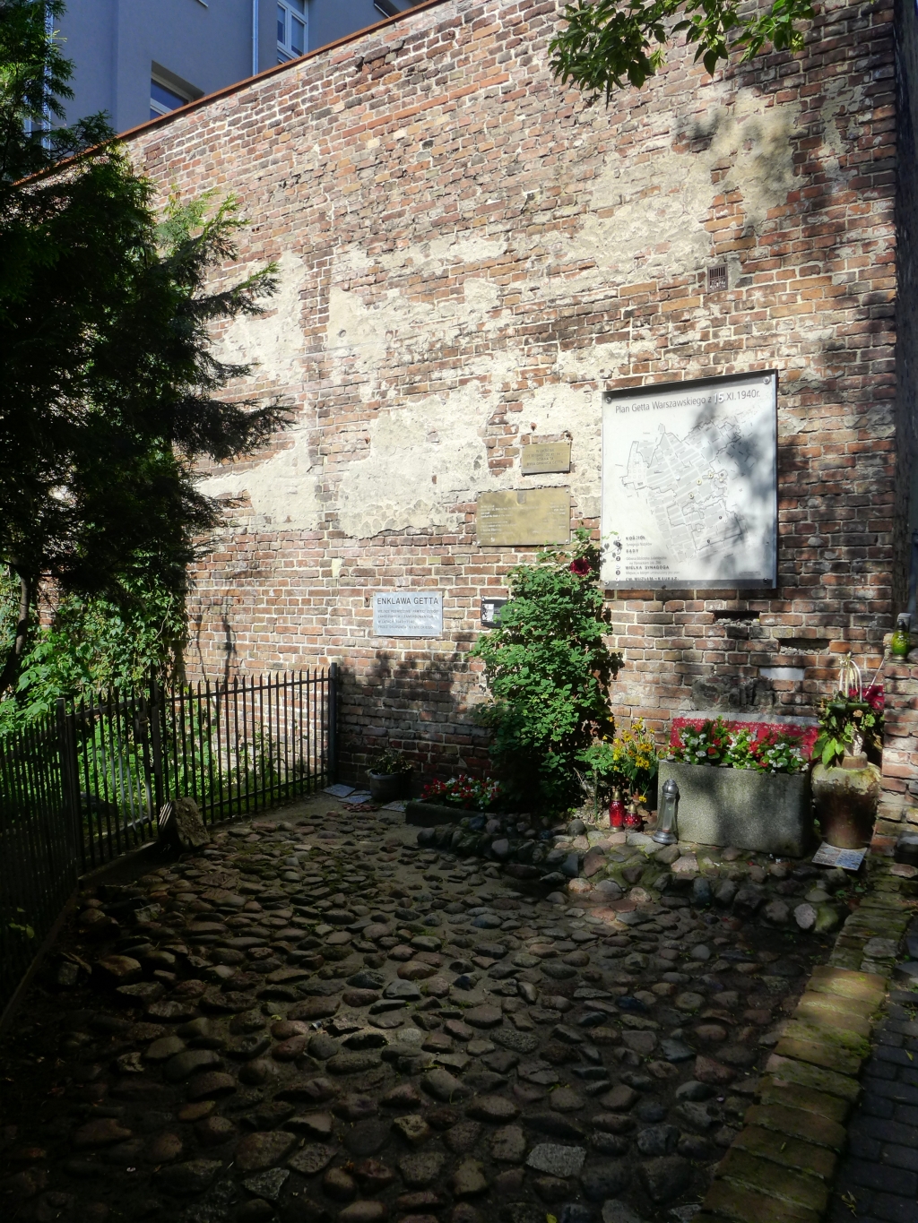
Wall fragments of so-called “Small Ghetto” that mark its boundaries to the south. They survived as a result of the exclusion of this area from actions undertaken by the occupying forces during the Great Action in August 1942.
55 Sienna Street – in this place the ghetto border was marked by the wall, which existed before 1940, between two buildings in 53 Sienna and 55 Sienna Street. It is about 3 metres high, and there are two bricks missing, as they were taken out in 1989 and afterwards transported to the Holocaust Museum in Washington (it is there where you will also see an exact copy of this fragment of the wall).
Stroll across the yard towards the south and you will find the second remaining part of the wall in Złota Street.
62 Złota Street – this fragment of the ghetto wall is a part of pre-war building wall about 6 meters high. Single bricks from this fragment were sent to the Yad Vaszem Holocaust History Museum in Jerusalem and to museums in Houston and Melbourne.

HOW TO GET TO THE NEXT STOP
If you stay a short while in Sienna Street, you will get the chance to admire the preserved pre-war appearance of the street between numbers 41 and 55. To see the front façade of the next building, move back to the north in the direction of Śliska Street.
BACK TO THE MAP / BACK TO THE LIST
2. BERSOHN and BAUMAN CHILDREN’S HOSPITAL
60 Sienna Street and 51 Śliska Street
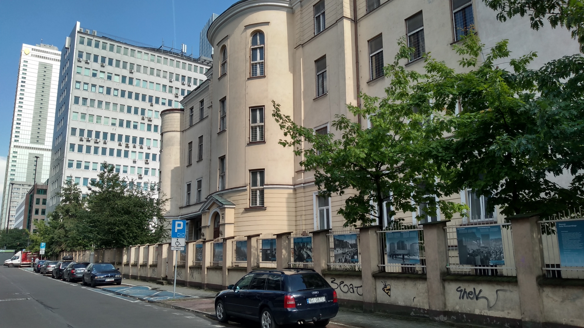
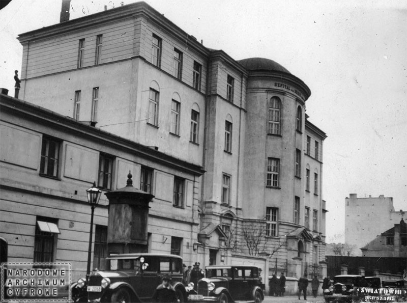
Photo: the hospital in 1930, source: Narodowe Archiwum Cyfrowe (National Digital Archives)
The hospital for the Jewish children of Warsaw and its surrounding area was built in 1878. It was funded by two Polish-Jewish families: Majer and Chaja Bersohn and Salomon and Paulina Bauman. In the years 1905–1912, Janusz Korczak* worked in the hospital as a paediatrician. From February 1942, hospital employees, in secret from the German authorities, took part in research on starvation in the Warsaw ghetto. In August 1942, the hospital was moved to Stawki Street, only to be liquidated in September. One thousand patients and staff were transported to their death in Treblinka.
After the end of the war and its reconstruction, in the years 1946–1950, the hospital building housed the headquarters and apartments of the employees of the Central Committee of Polish Jews. Then it was readapted for medical purposes and a hospital for children suffering from contagious diseases was located there.
It is currently earmarked by the Warsaw magistrate to house the Warsaw Ghetto Museum to be opened in 2023.
* Janusz Korczak, born Henryk Goldszmit, was a Polish-Jewish educator, author of books for the youngest of readers, pedagogue and paediatrician known as Pan Doktor (“Mr. Doctor”) or Stary Doktor (“Old Doctor”). During the Great Action, he was taken along with the orphans in his care to the Nazi death camp in Treblinka. He died together with the children in his care.
HOW TO GET TO THE NEXT STOP
Walk to the east and look out for the Angler’s House – you’ll see the logo saying “Dom Wędkarza”.
BACK TO THE MAP / BACK TO THE LIST
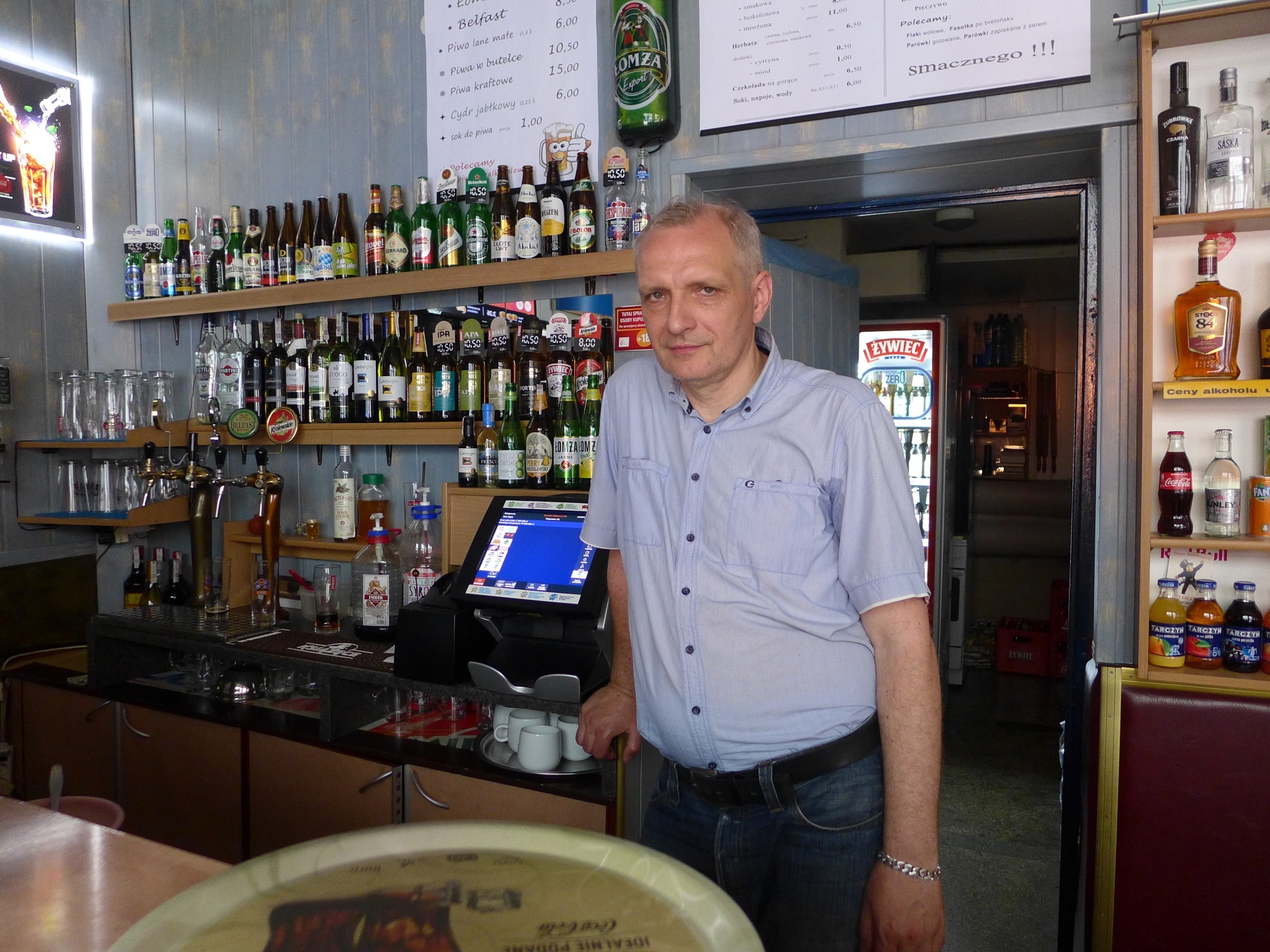
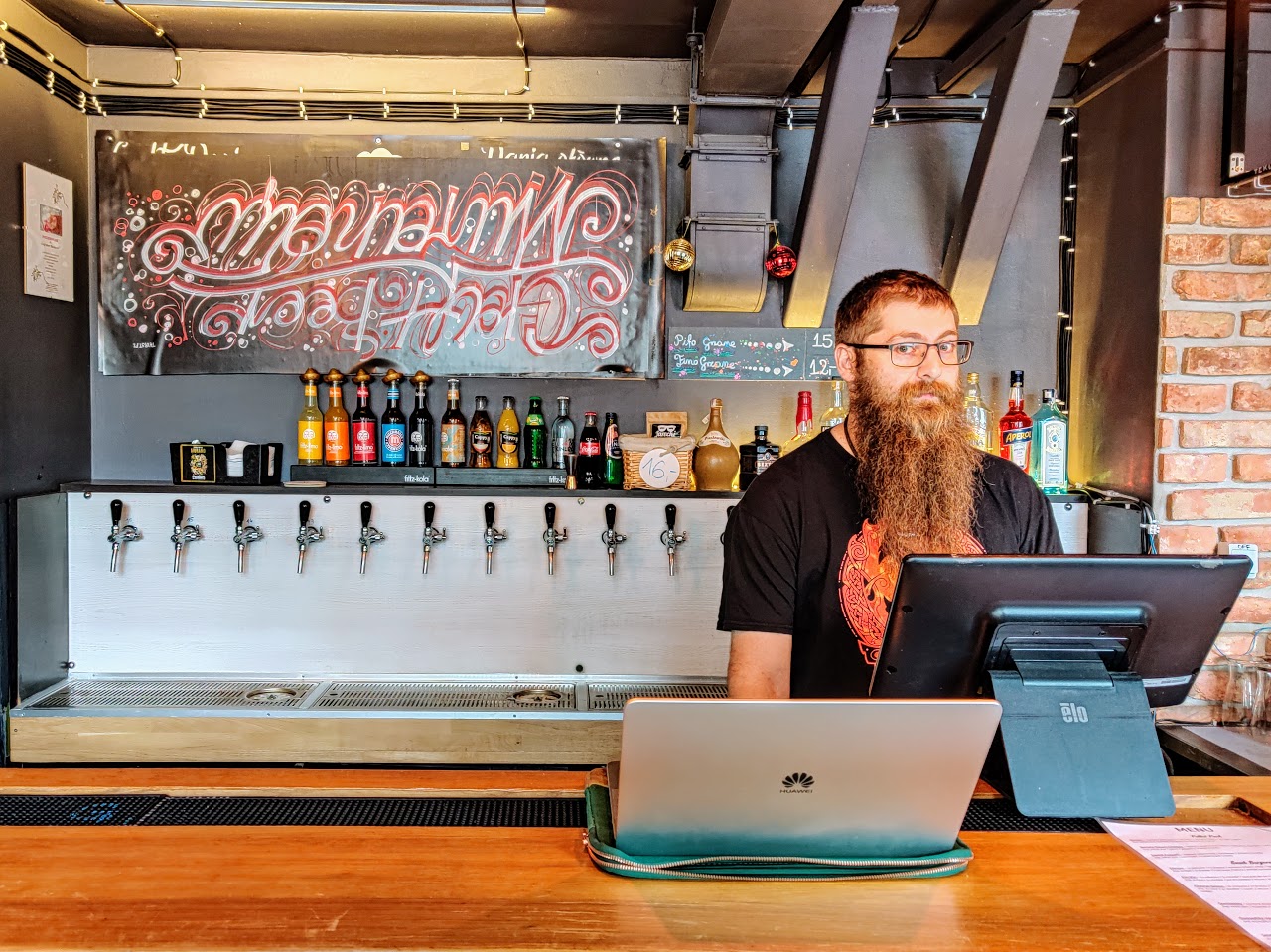
3. CHMIELARNIA
42 Twarda Street
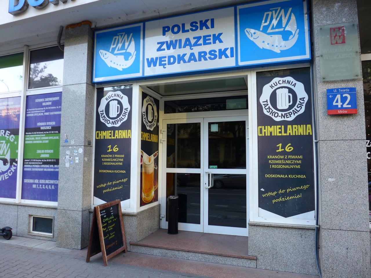
Chmielarnia
The pub’s Facebook page
Number of taps: 16
Current menu: ontap.pl
Cuisine: Thai and Nepalese
Opening hours:
Monday-Friday: 11 pm–10 pm
Saturday: noon–11 pm
Sunday: noon–10 pm
One of the first multitap pubs on the left bank of the Vistula River, established at the height of the “Warsaw beer revival” in the spring of 2013. The location in the basement of the Angler’s House makes it superbly unique. An undoubtedly distinguishing feature of this place are the scrumptiously delicious dishes cooked by Nepalese people.
Chmielarnia is the place where 250 ml and 125 ml glasses were first used (in addition to the classic 500 and 330 ml). The smallest volume is used to enjoy tasters on “beer boards”. Now these small glasses are a necessity if you wish to check several brews out safe that you’ll make it back home in one piece. Merrymaking made safe, the risk of your thoughts drowning in excessive ABV gone for good.
In the summer, a beer garden with four additional taps is opened on a nearby square. Even though it is located in Śródmieście, Twarda Street is outside the main communication routes. This makes it an amazing peaceful haven in the very heart of the city. Sit down, relax and take in the scenery.
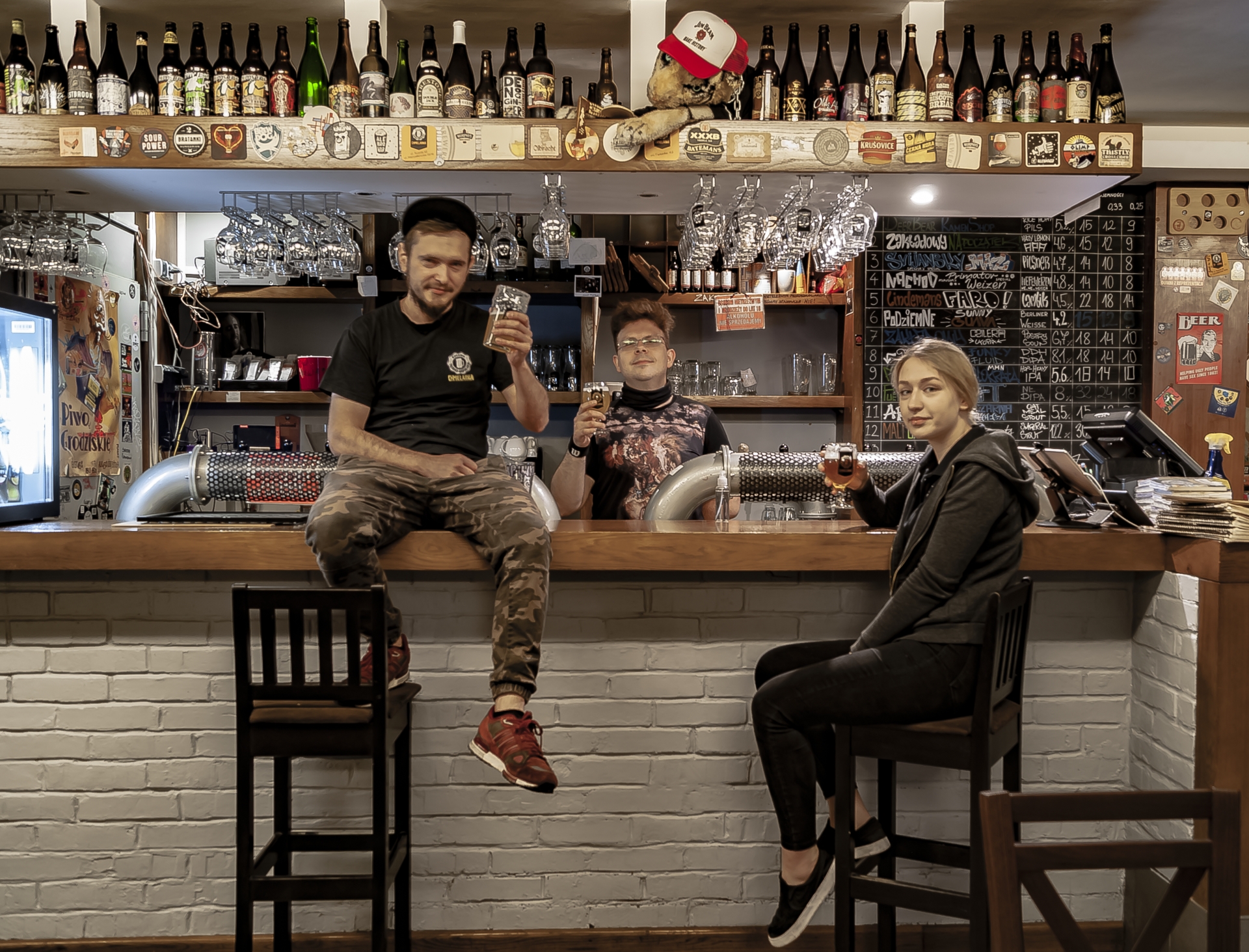
Photo courtesy of Chmielarnia
HOW TO GET TO THE NEXT STOP
Head north along Twarda Street and, having crossed Prosta Street, go around the buildings in front of you. When you get to the Mint (Mennica), turn right towards Pereca Street. The buildings in Waliców should be in sight. You can also take the 157 to Sienna-Norblin – it’s just one stop though.a ul. Żelaznej autobusem 157 (Sienna-Norblin).
BACK TO THE MAP / BACK TO THE LIST
4. TENEMENT HOUSES & GHETTO WALL
Waliców and Pereca streets
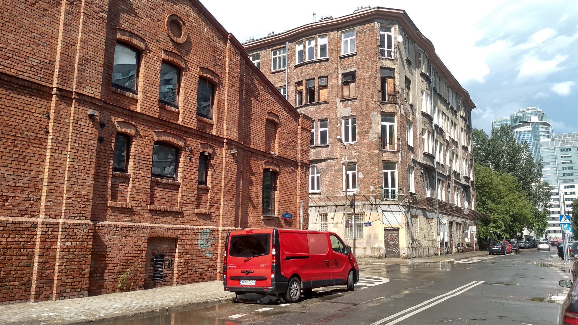

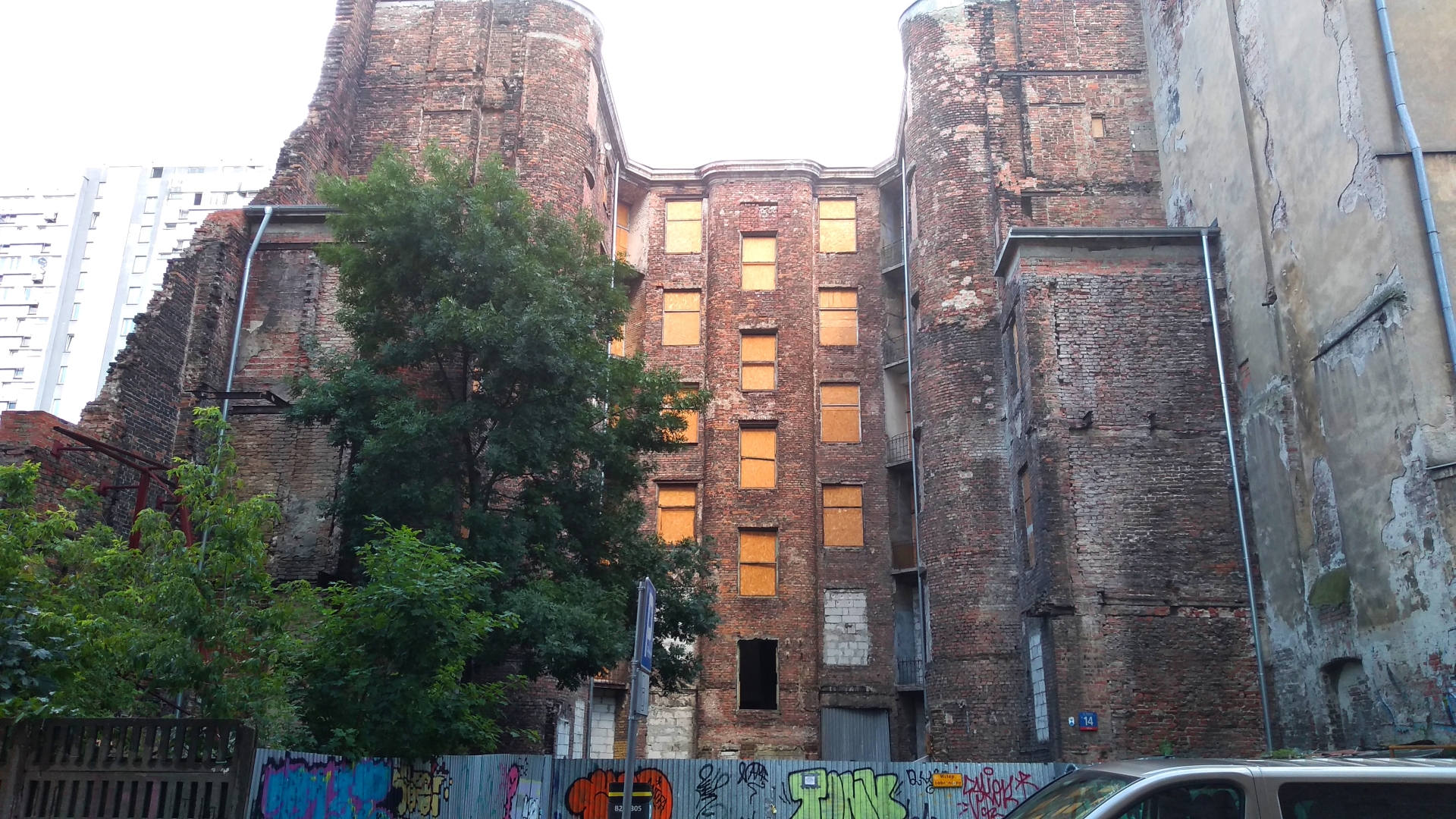
A part of the city with preserved buildings which made up the ghetto and at the same time were associated with brewing traditions.
As early as 1763, two breweries operated in Waliców owned by Anna Raubach and Henryk Grodke, respectively. Over the next 20 years, the entire neighbourhood was parcelled out and acquired an either industrial or agricultural character. At that time, 10 breweries and a brickyard operated in immediate vicinity of this place. In 1854, on the plot between Żelazna, Grzybowska, Waliców and Ceglana streets, the large Jung Brewery was established, enlarged from the Kazimirus Brewery which had existed since 1824. After the death of Herman Jung, the plant in Waliców was liquidated, and in 1919 the company run by Herman’s son Seweryn became part of the United Breweries Joint-Stock Company “Haberbusch i Schiele”.
Waliców 11 – the preserved wall of the building belonging to the former Herman Jung Brewery. It was part the ghetto from November 1940 until August 1942.
Waliców 10, 12 and 14 – tenement houses from 1910-1914 entered in the register of historic monuments in 2018.
HOW TO GET TO THE NEXT STOP
Northbound 5 minutes along Waliców Street, then turn left on Chłodna Street to reach the intersection with Żelazna Street.
BACK TO THE MAP / BACK TO THE LIST
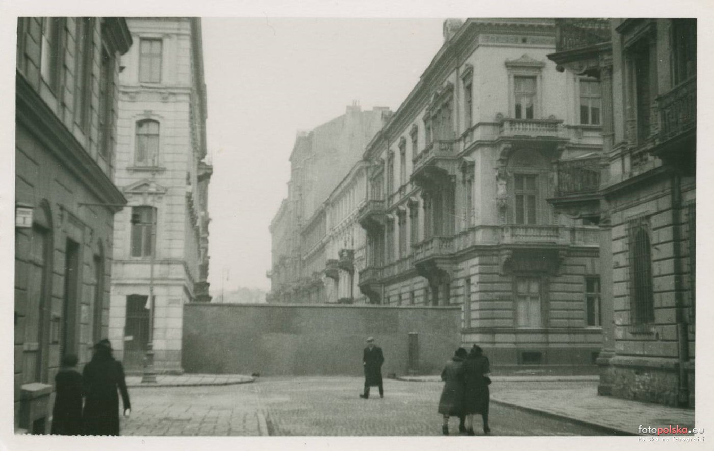
5. The BRIDGE between the “SMALL” and the “BIG” GHETTO
crossroads of Chłodna Street and Żelazna Street
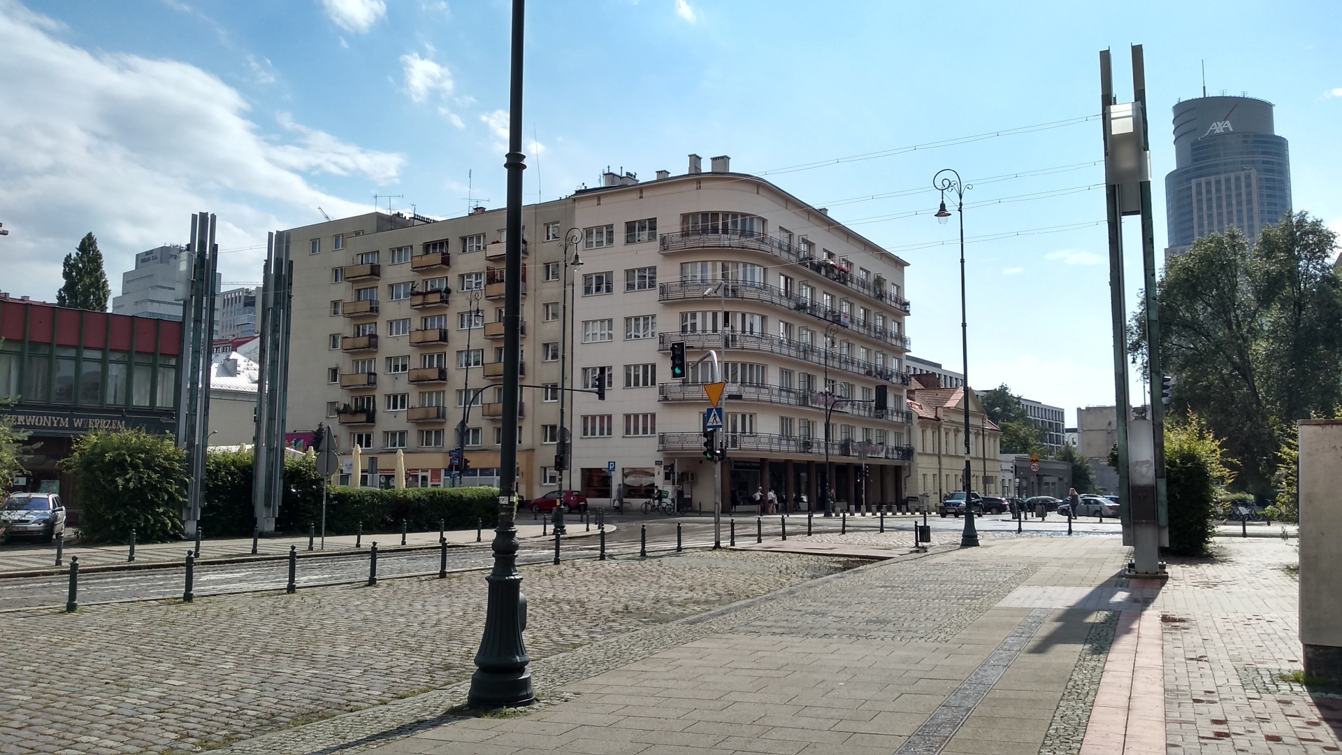

Photo: the bridge in 1942, source: pl.wikipedia.org
This is the place where once stood one of the symbols of the Warsaw Ghetto: a wooden bridge built over Chłodna Street, made available to ghetto inhabitants on 26th January 1942.
In December 1941, the section of Chłodna Street between Wronia and Żelazna streets was excluded from the ghetto. The only connection between the two parts of the closed district was the narrow passage at the crossing of Żelazna and Chłodna streets. In January 1942, a wooden bridge was erected between the tenement houses in 23 and 26 Chłodna Street. The two-storey structure, with fifty-step stairs on each side, was the largest of the four pedestrian bridges that were built in the ghetto. The bridge, designed by the German company Schmied and Müntzermann, was financed by the Jewish Council. It was called by the ghetto inhabitants the “bridge of sighs”, because they could see the part of Warsaw inaccessible to them. Demolished after the Great Action in August 1942.
In 2011, the Footbridge of Memory (Kładka Pamięci) was built on the site of the bridge – a monument in the form of an artistic installation designed by Tomasz Lec.
HOW TO GET TO THE NEXT STOP
Go north along Żelazna Street, then turn right onto Solidarności Avenue. Walking time is approximately 10 minutes. You can also use public transport: take the 157 bus from Chłodna bus stop to Wola Ratusz and then any tram to Kino Femina.
BACK TO THE MAP / BACK TO THE LIST
6. CAFE BAR PARAGRAF
84 Solidarności Avenue

Cafe Bar Paragraf
The pub’s Facebook page
Number of taps: 2
Cuisine: snacks
This place is a perfect example of the “Café Bar” category created in the Polish People’s Republic. Opened in the 1960s, it is one of the few survivors of this type on the foodie map of the city. It has been run by Mr. Adam since the beginning of the 90s, after being taken over from the state-owned Społem cooperative.a.
In case you’re here for the coffee, order espresso, but keep in mind there’s plenty of stronger alcohols there too. When it comes to beers, it is worth having a pint o’ Belfast – a dark lager which in the early 1990s was a symbol of the aspirations of Polish brewers towards making a proper stout, available back then solely in Irish Pubs. For those who absolutely must try “craft” – there’s bottled beer.
HOW TO GET TO THE NEXT STOP
The Court building is located precisely on the other side of the street.
BACK TO THE MAP / BACK TO THE LIST
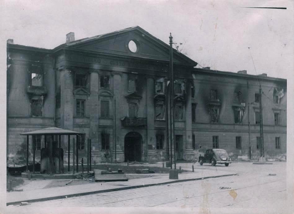
7. LESZNO COURTHOUSES
127 Solidarności Avenue
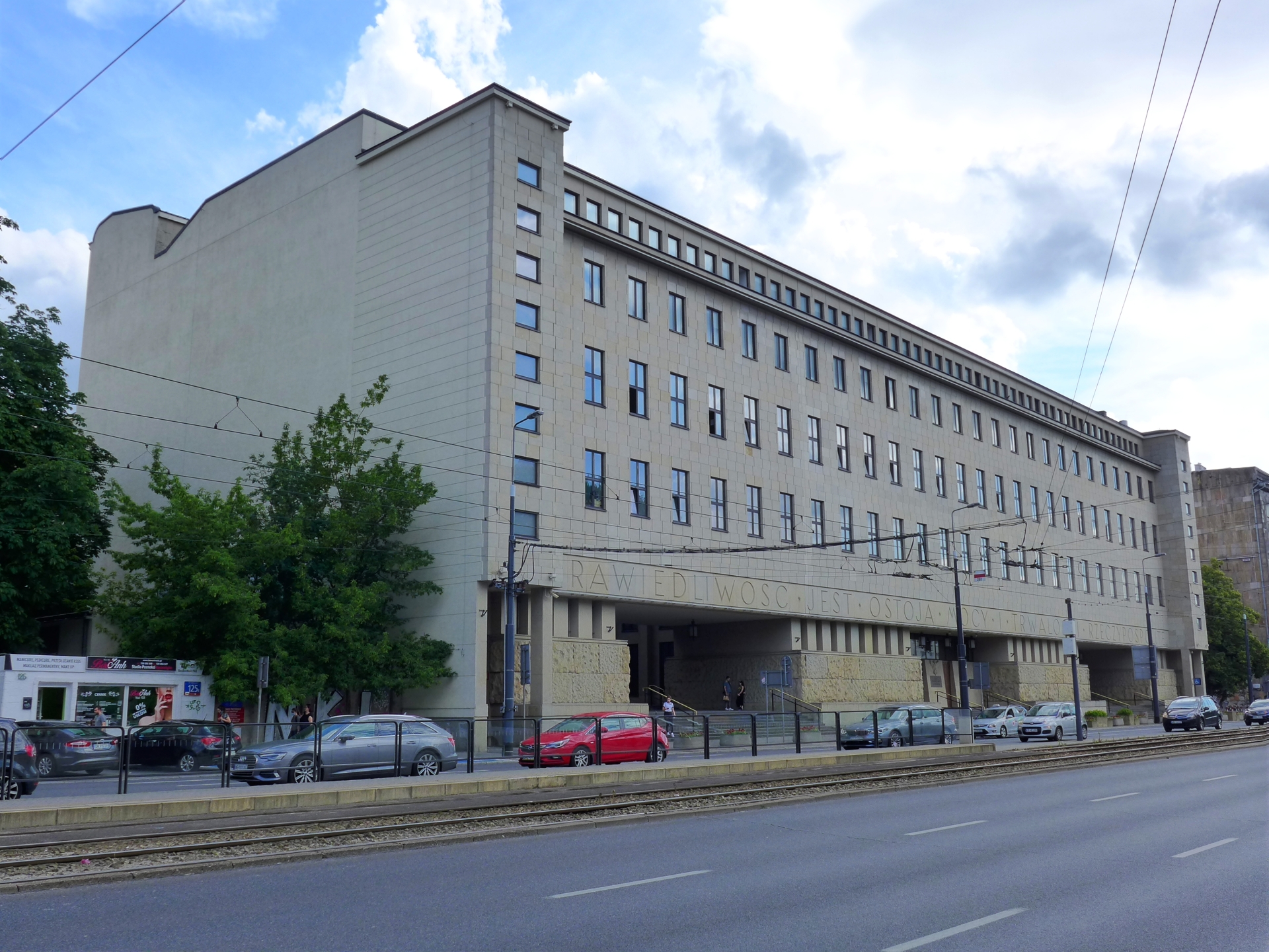
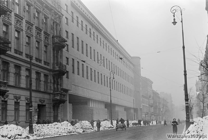
The building of the Municipal Courts located at the then Leszno Street were officially opened in June 1939. At that time, this was the largest court building in Europe. Due to its functions, the building of the Courts was not incorporated into the Warsaw ghetto in November 1940. It became the meeting place for people from both sides of the ghetto wall – Jews (from Leszno Street) and Poles (from Biała Street) alike had access to the building. As a result, it was possible to escape from the ghetto as well as smuggle food and medicines.
HOW TO GET TO THE NEXT STOP
Wsiądź w dowolny tramwaj kierujący się na południe z przystanku Kino Femina 09. Wysiądź na następnym przystanku Hala Mirowska i idź w kierunku przedwojennych hal na południe. Za halami skręć w lewo na wschód do parku i idź ok. 200 metrów aleją Drzewieckiego. Za placami zabaw skręć w prawo na południe w kierunku Placu Grzybowskiego.
BACK TO THE MAP / BACK TO THE LIST
8. CZEŚĆ
2 Grzybowska Street
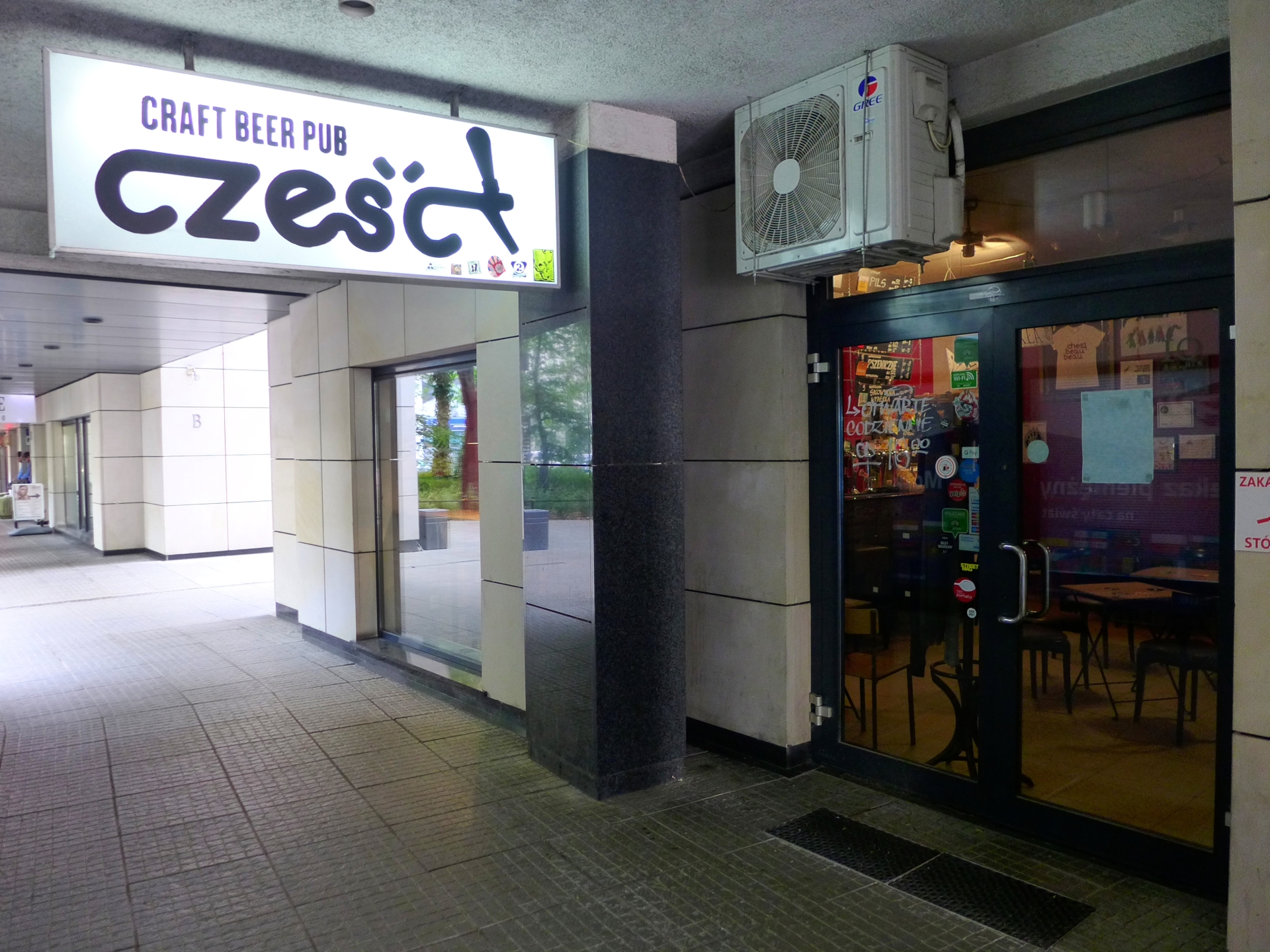
Cześć – the name of the pub mean “Hi!” in Polish
The pub’s Facebook page
Number of taps: 9
Current menu: ontap.pl
Cuisine: snacks
Opening hours:
Monday-Thursday: 4 pm–midnight
Friday-Saturday: 4 pm–1 am
Sunday: 4 pm–midnight
Few places in the centre of Warsaw can boast of a truly “neighbourly” atmosphere. Mainly regulars come here, but casual visitors are of course very welcome. This is undoubtedly due to the fact that behind the bar we always meet one of the owners – Piotrek or Kuba. This is a real rarity in the capital city’s multitap scene.
The taps are full of novelties from Polish craft breweries, served in proportionally priced 500, 300 and 200 ml glasses. From time to time, loud parties are organised here, including the famous two-day birthday party or a “New Year’s Eve house party”. Unpretentious and direct, always with good music from psychobilly to unconventional rock.

HOW TO GET TO THE NEXT STOP
Go south to Grzybowski Square, then turn left on the square east into Próżna Street.
BACK TO THE MAP / BACK TO THE LIST
9. PRÓŻNA STREET
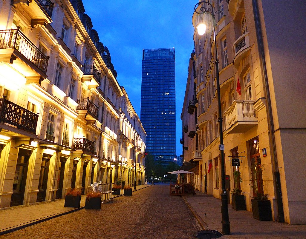
A unique place in the heart of Warsaw, where the buildings on both sides of the former ghetto street have survived.
In November 1940, the western part of the street, on the section between Zielna Street and Plac Grzybowski, was within the boundaries of the Warsaw Ghetto. It was excluded from it a few months later, in March 1941, after the Germans moved the ghetto border in this area to Grzybowski Square and the line of Bagno and Wielka streets.
The tenement houses, built at the end of the 19th century, were entered in the register of historic monuments in 1987. Three of them were renovated in 2013-2014. The Majer Wolanowski tenement house located on the side of Grzybowski Square is still waiting for restoration.
HOW TO GET TO THE NEXT STOP
Use public transport. Go east to Zielna Street and take the metro from Świętokrzyska station to Ratusz-Arsenał – that’s 1 stop. Alternatively, go to Marszałkowska Street and walk north to Królewska Street. From there, any tram going northbound from Królewska tram stop to Metro Ratusz-Arsenał – that’s 2 stops. The next stop on this trail is on the eastern side of the historic Arsenal building in Długa Street.
BACK TO THE MAP / BACK TO THE LIST
10. NALEWKI STREET & ENTRANCE to the KRASIŃSKI GARDENS
Stare Nalewki Street
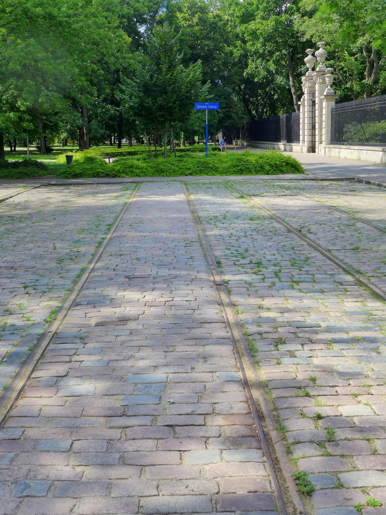

Nalewki was the main street of the Northern Jewish District, also known as the Nalewski-Muranów district. The contemporary Stare Nalewki Street is a preserved section of the former Nalewki Street. In the years 1940–1943, it was located outside the Warsaw ghetto, but it was accessed by a gate situated at the intersection with Świętojerska Street. On 19th April 1943 at dawn, through this gate, German and collaborating Latvian and Ukrainian troops under the command of Ferdinand von Sammern-Frankenegg entered the ghetto encountering the armed resistance of Jewish fighters. This event marked the beginning of the Warsaw Ghetto Uprising. After the fall of the uprising, the northern part of the street belonging to the ghetto was completely demolished by the Germans.
In December 1953, the street was renamed Bohaterów Getta, in 2019 it was renamed to Stare Nalewki (today’s Nalewki Street is a small street located 100 metres to the west of historic Nalewki, between Ludwik Zamenhof and Stanisław Dubois streets; before the war that little street was called Gęsia – “geese street”).
In Stare Nalewski, you will find pre-war cobblestone and tram tracks from the early days of electric tram network with a historic unique width of 1525 mm. The baroque entrance gate to the Krasiński Garden is a survivor of the war.
HOW TO GET TO THE NEXT STOP
Continue north towards Świętojerska Street, then turn left to the west. Cross Władysław Anders Avenue heading west along Mordechaj Anielewicz Street. You will walk more or less 10 minutes. Or you can take the 180 bus from the intersection from Muranów to Nalewki-Muzeum bus stop.
BACK TO THE MAP / BACK TO THE LIST
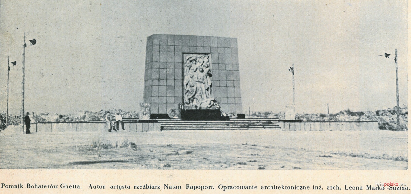
11. GHETTO HEROES MONUMENT & POLIN MUSEUM of the HISTORY of POLISH JEWS
Bohaterów Getta Warszawskiego Square
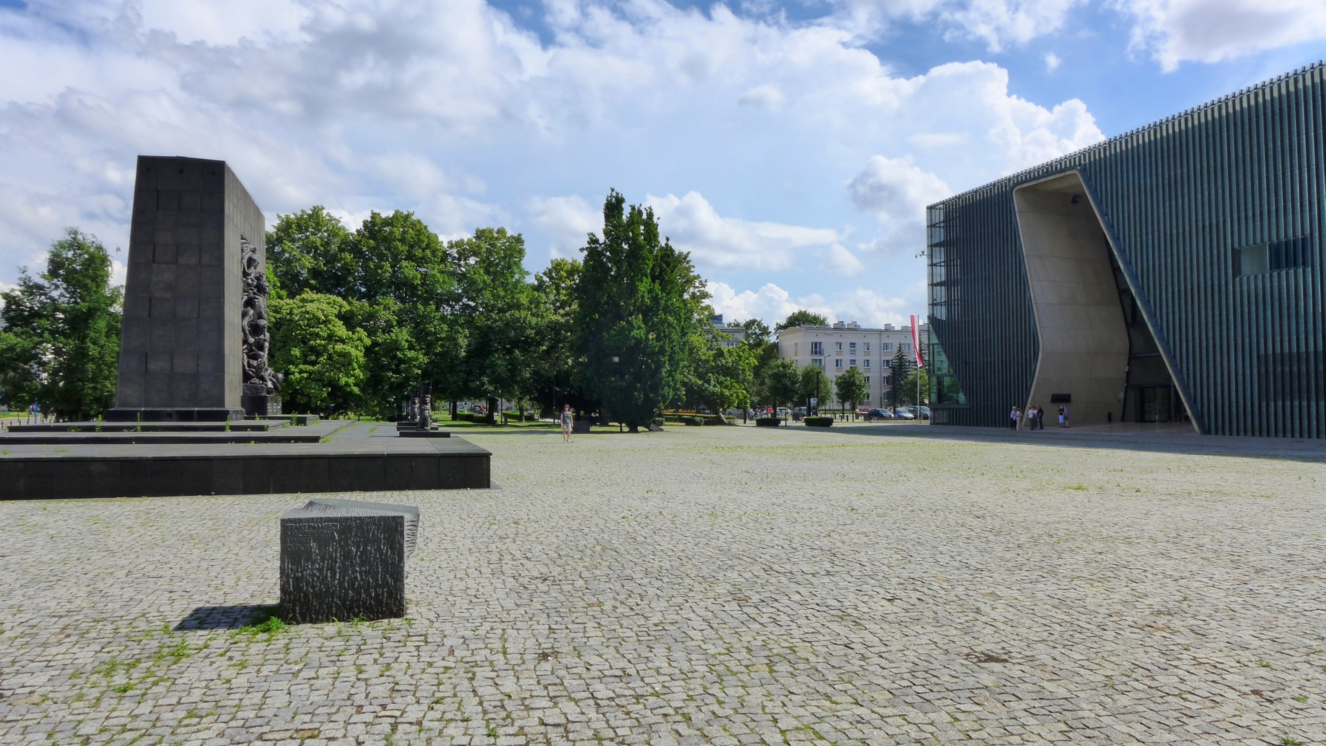
In the 19th century, this area housed the Crown Artillery Barracks (later renamed to Volyn Barracks). In the interwar period, a military prison was established here. From August 1942 until the final liquidation of the ghetto, the Warsaw Judenrat, or the Jewish Council, had its second and last official headquarters in the building of the former barracks in 19 Zamenhof Street.
In the 19th century, this area housed the Crown Artillery Barracks (later renamed to Volyn Barracks). In the interwar period, a military prison was established here. From August 1942 until the final liquidation of the ghetto, the Warsaw Judenrat, or the Jewish Council, had its second and last official headquarters in the building of the former barracks in 19 Zamenhof Street.
In 2013, the Museum of the History of Polish Jews was opened next to the monuments – its exhibitions document the centuries-long history of the Jewish minority in Poland.
HOW TO GET TO THE NEXT STOP
Walk a few dozen steps along Karmelicka Street to the north until you reach Stawki Street.
BACK TO THE MAP / BACK TO THE LIST
12. UMSCHLAGPLATZ
5/7 and 10 Stawki Street
Back in the day, this used to be an area of railways, ramps and warehouses. Until 1939, the Storehouse for the Warsaw Municipal Supply Plants was located here. In December 1940, part of this area renamed to by the Germans to Umschlagplatz (Reloading Square) was taken over by a special German institution, Transferstelle (Transfer Office), which controlled the official trade between the closed district and the “Aryan” side. The goods ordered for the ghetto were delivered to the railway ramp at Umschlagplatz where the Germans set the ghetto’s customs border.
From 22nd July 1942, railway structures, ramps, the building of elementary schools and other buildings located in this area began to be used as a place for the selection, detention and loading of Jews before transporting them to the extermination camp in Treblinka. The so-called Grossaktion Warschau (Great Action) was part of the general project Einsatz Reinhardt (Action Reinhardt) whose aim was to exterminate the Jewish population in the General Government.
From 22nd July until 21st September 1942, about 300,000 Jews were transported from the ghetto to Treblinka – that’s 75% of its inhabitants. In 1943, during the liquidation of the ghetto, over 40,000 people passed through the Umschlagplatz to Treblinka and the camps located in the Lublin region: Majdanek, Trawnik and Poniatowa.
The buildings of primary schools opposite each other have survived to this day. The Department of Psychology of the University of Warsaw (No. 5/7) is now located in the one where the headquarters of the SS unit supervising the deportations was located. In turn, at the back of the school building at no. 10, the wall that forms the border of the Umschlagplatz has been preserved.
In 1988, on the eve of the 45th anniversary of the outbreak of the Warsaw Ghetto Uprising, a monument designed by Hanna Szmalenberg and Władysław Klamerus was unveiled. It symbolises an open railway car.
HOW TO GET TO THE NEXT STOP
Go eastbound along Stawki Street and then turn right onto Dubois Street.
BACK TO THE MAP / BACK TO THE LIST
13. ANIELEWICZ’S MOUND & BUNKER
Miła and Dubois streets
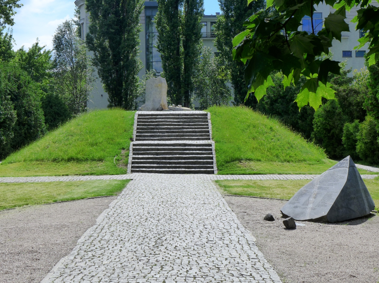
During the Ghetto Uprising, the headquarters of the Jewish Combat Organization ŻOB were located in 29 Miła Street. After their discovery by the Nazis, they were moved to the bunker in 18 Miła Street. It was a large bunker, well equipped in weapons and stocked with food, with running water and electricity, built under a tenement house destroyed in September 1939. It belonged to the Jewish criminal underworld (the so-called czomps*) commanded by Szmul Asher.
On 8th May 1943, the bunker where approximately 300 people were sheltered was surrounded by German and Ukrainian troops. Some of the people (mainly civilians) surrendered after the Nazis called for surrender and left the bunker. The ŻOB soldiers who stayed inside tried to fight a doomed fight, but the Germans started letting gas inside. In this turn of events, about 120 fighters committed mass suicide.
The underground bunker became a mass grave, as no exhumation works were carried out in 18 Miła Street after 1945. In 1946, at the initiative of the Central Committee of Polish Jews, a mound (dubbed the Anielewicz Mound) was erected from the rubble of the surrounding houses in the place where the bunker was located.
* Czomp can be roughly translated into English as thug or cutthroat.
HOW TO GET TO THE NEXT STOP
Continue along Dubois Street, which is an extension of Miła Street.
BACK TO THE MAP / BACK TO THE LIST
14. CRAFT BEER MURANÓW
23 Andersa Street
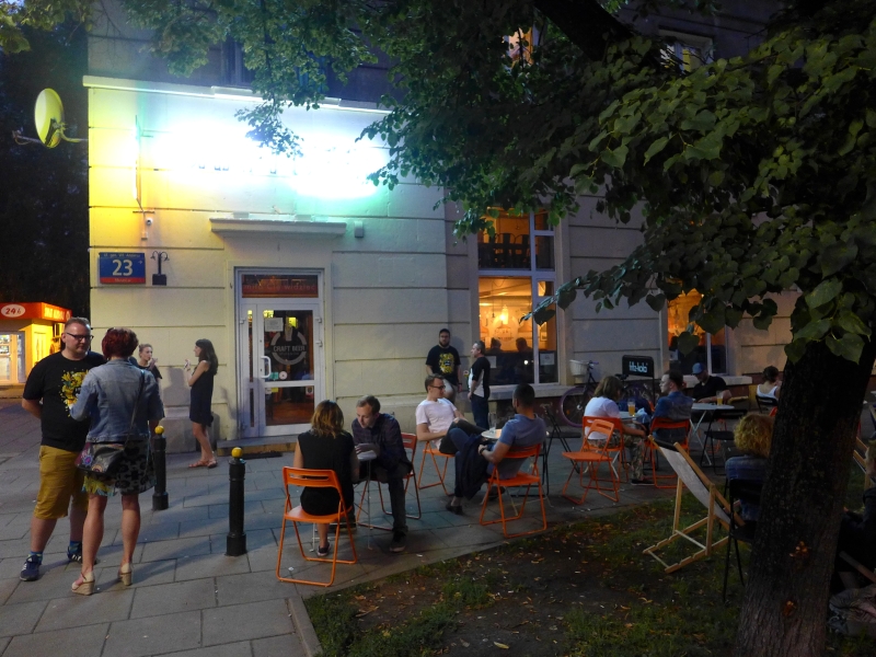
Craft Beer Muranów
The pub’s Facebook page
Number of taps: 16
Current menu: ontap.pl
Cuisine: hot-dogs and burgers
Opening hours:
Monday-Thursday: 3 pm–midnight
Friday-Saturday: 3 pm–1 am
Sunday: 3 pm–11 pm
The pub opened in 2017 and is located in one of the socialist realist houses built in the 1950s. So here we have a two-in-one situation – post-war communist architecture and the atmosphere of the Jewish Northern District and the so-called “Big Ghetto” that refuses to be forgotten. The memorial sites are only a few or a dozen minutes’ walk from here.
The place itself is one of the larger multitaps in Warsaw and boasts not only a ground floor and outdoors beer garden in the summer, but a mezzanine too. Their offer includes a prime selection of craft beer, both from Poland and abroad, on tap and bottled. There is also prosecco and ciders, or something stronger for those looking for higher ABV.
If this trail has inspired you to find out a little more about the Jewish history of Warsaw, visit any of the following websites:
- Warsaw Ghetto on Wikipedia (in English / auf Deutsch / en français)
- Entries about the Warsaw Ghetto on the website of the Jewish Historical Institute
- Warsaw Ghetto Museum
- Photos from the report by SS-Gruppenführer Jürgen Stroop “The Jewish residential district in Warsaw no longer exists” in the Archives of the Institute of National Remembrance IPN
- Internetowa Baza Danych Getta Warszawskiego